Weather: The present conditions of the atmosphere.
Weather Instruments
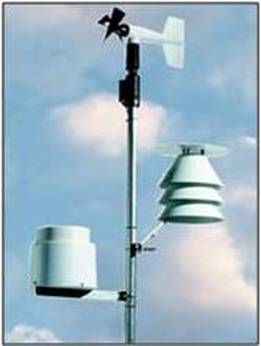
Main Weather Instruments
|
Anemometer:
Measures wind speed and direction |
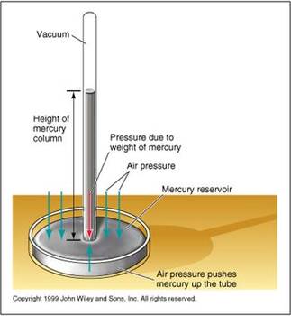
Barometer:
Measures atmospheric pressure |
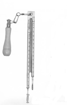
Sling Psychrometer:
Measures dew point and relative humidity |
Air Masses and Fronts
|
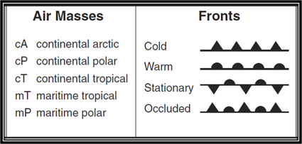
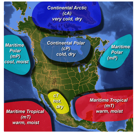
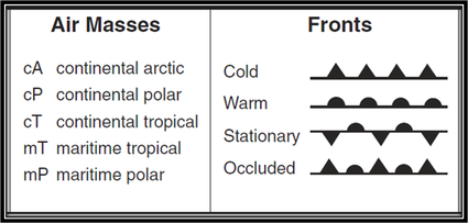
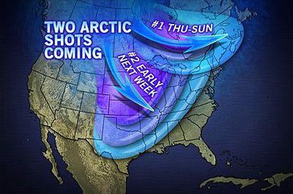
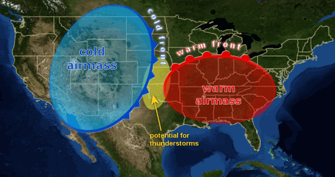
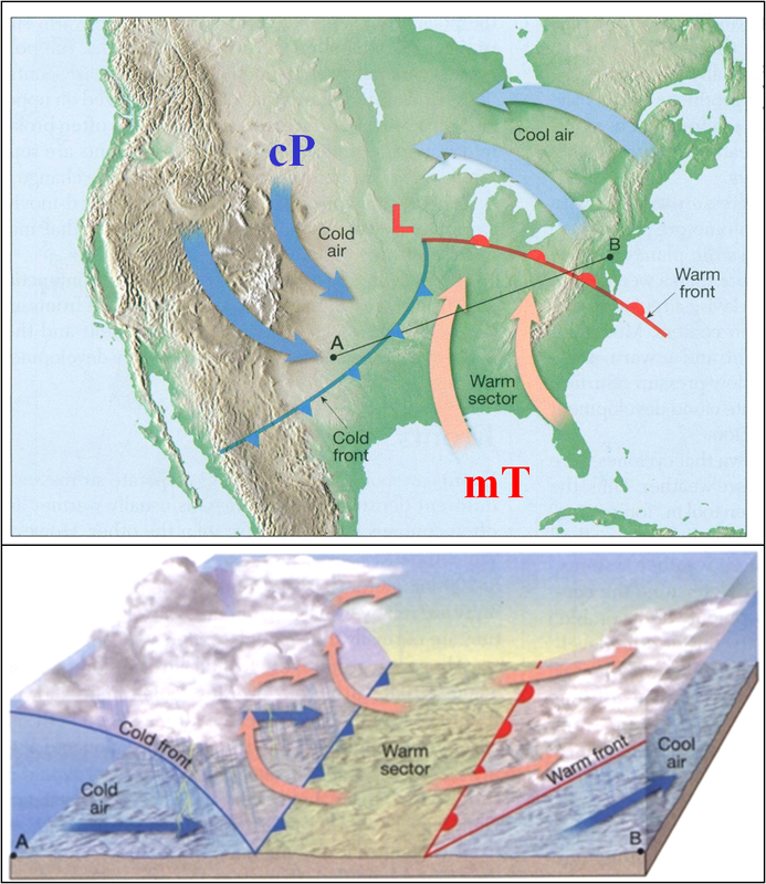
A large body of air with the same characteristics of temperature and moisture content is known as an air mass. An air mass receives its characteristics from the location it forms, know as its source region. Fronts represent the advancing edge of the air mass at ground level. Only low pressure systems have fronts, due to air masses converging at the low pressure. There will be much more on pressure systems and fronts in a future lesson. Air Mass Classification Category 1: Moisture Content (land/sea) The first letter in the symbol for classification is always lowercase, and is based on the following criteria:
- Dry / Arid
- Moist / Humid combined with... |
|
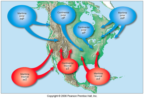
Category 2: Temperature (Polar / Equatorial)
The second letter in the classification symbol is CAPITAL
The second letter in the classification symbol is CAPITAL
- Polar (P): Forms at high latitudes near poles (cold)
- Tropical (T): Formed in low latitudes near equator (warm)
- Arctic (A): Formed AT poles, ONLY FORM DURING THE WINTER (frigid / extreme cold)
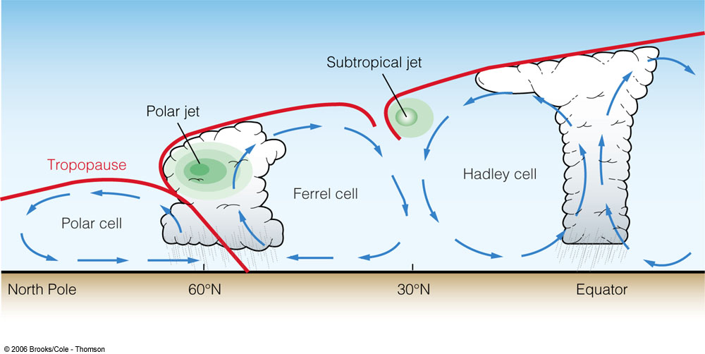
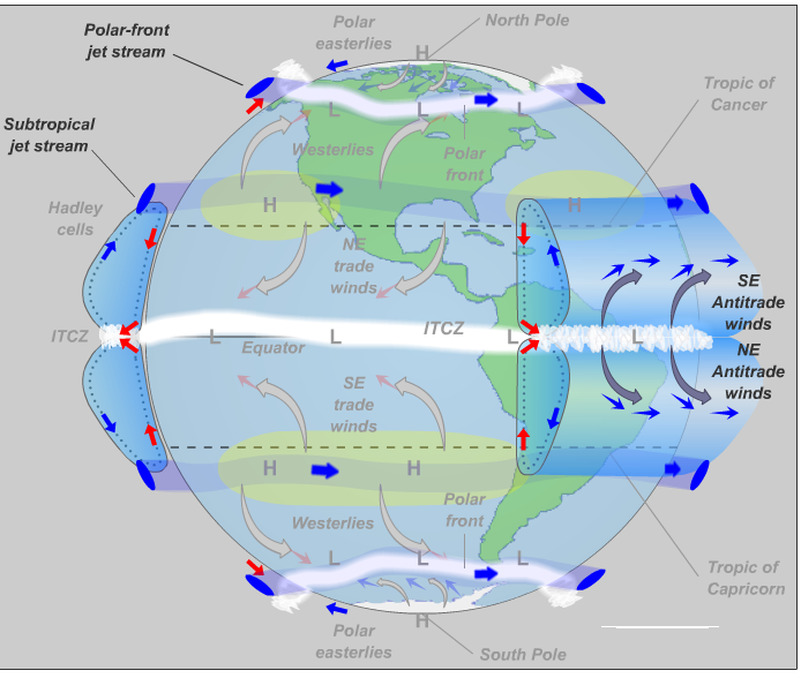
The diagram on the left above shows the movement of air masses between latitudes. This will be the focus of an upcoming lesson, but the basics are that winds are driven by differences in air temperature, which leads to differences in density and pressure.
Review Games:
Frontal Boundary Precipitation
|
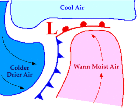
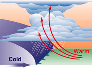
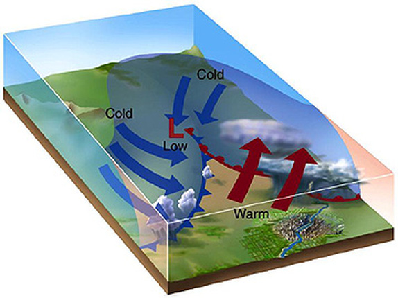
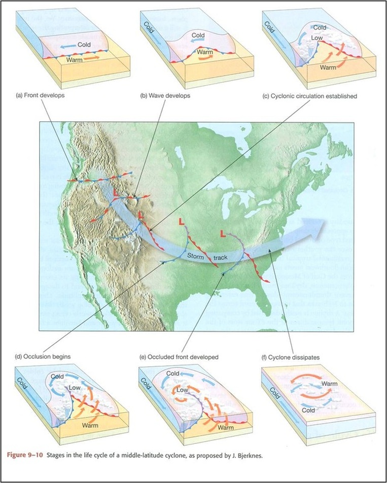
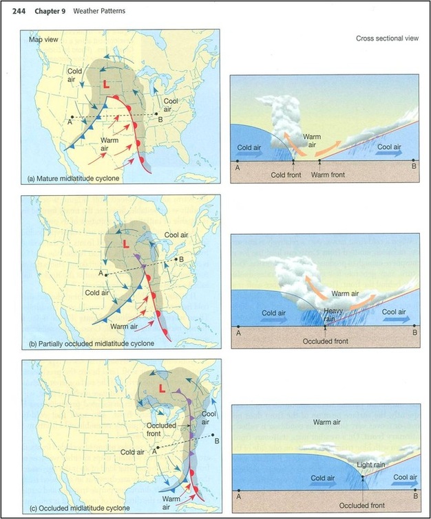
Fronts represent the ground level boundaries between two air masses that converge at the center of low pressure. Low pressure is created by warm air rising as colder, higher density air converges with it. This takes place along frontal boundaries and at the center of low pressure, which leads to these locations having a lot of cloud formation and precipitation.
|
Use the animation below to see both warm and cold front interactions over time.
Synoptic Weather Maps
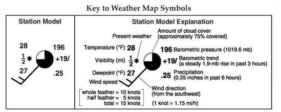
Station Models and Weather Maps
Isotherms:
|
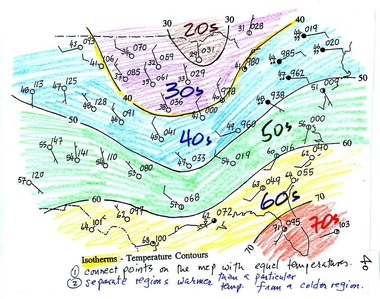
Isotherms connect points of equal temperature.
They tend to run east to west across the country. This is because latitude is the largest factor in determining a locations temperature, and latitudes run east to west. Their is usually a bend in the isotherms located in the central part of the country. This is due to differences in heating rates of land vs. water, and how far away from the oceans the region is. |
Isobars:
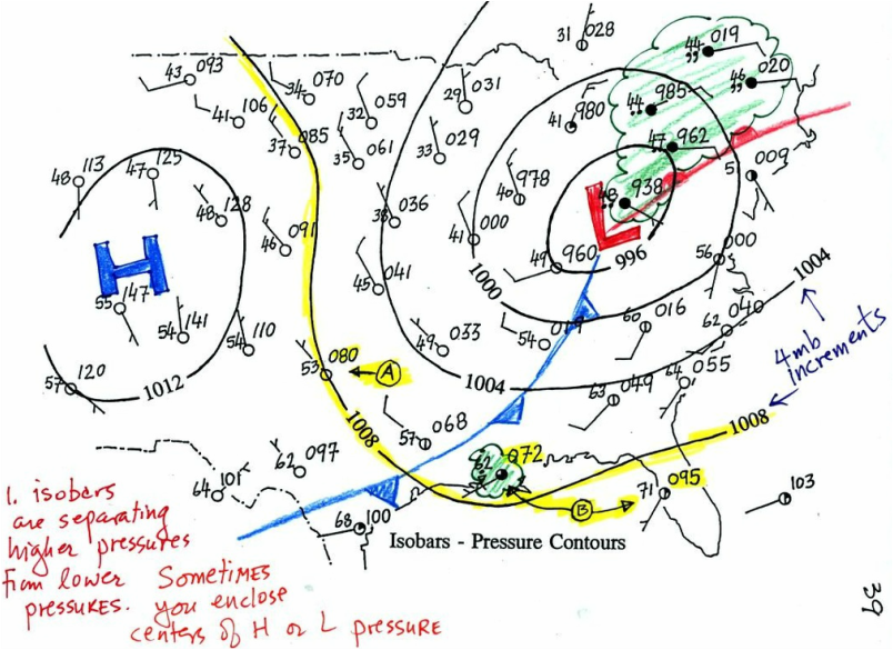
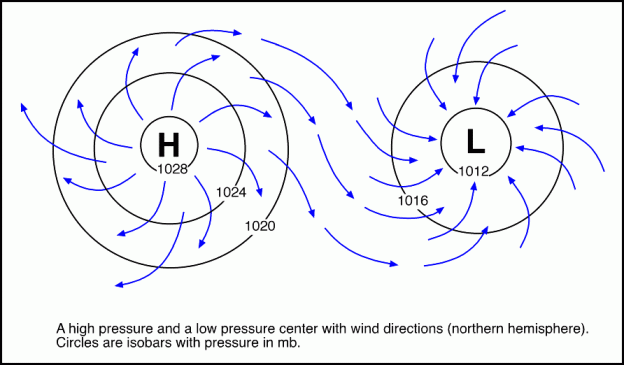
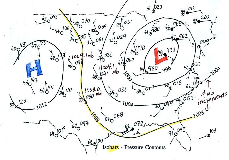
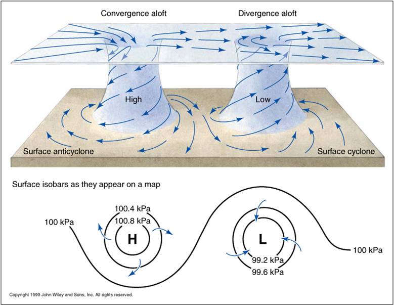
Isobars are lines that connect points of equal barometric (air) pressure. They commonly form circles around the centers of high and low pressure that occur one after another.
|
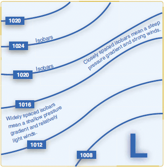
Air pressure flows from areas of high to low concentration, so careful analysis of the barometric pressure values on isobars can indicate the direction wind flow. The line spacing on a map shows how fast winds are moving, and the direction they are heading. The closer the isobars are to each other, the steeper the pressure gradient and the stronger the winds. The diagram to the right illustrates the relationship between spacing and speed. |
Frontal Boundaries on Weather Maps:
|
Front Symbol goes on the side of the line that the air mass is moving toward. The cold front always moves faster than the warm front. This allows cold fronts to catch up to the warm front, and essential zip the two fronts together like a zipper. The section where this occurs is called an occluded front. |
BIG Storm Weather Patterns
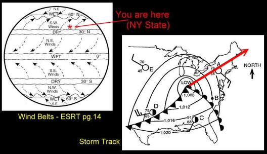
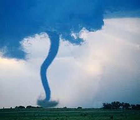
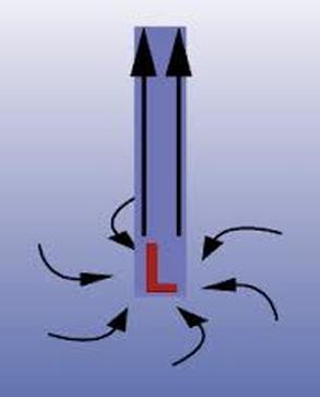
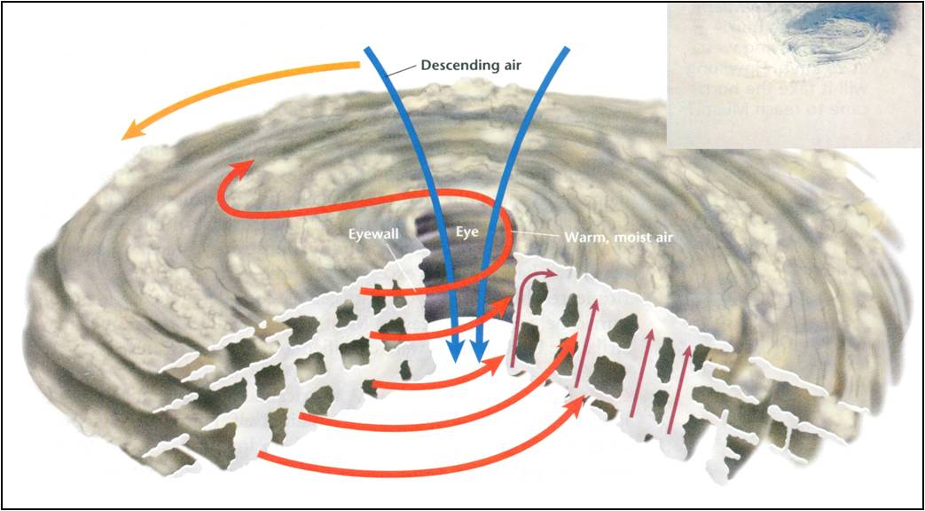
- Cloud formation and stormy weather, from a gentle rain, to a tornado or hurricane, is associated with low pressure systems
- The lower the pressure system, the more powerful the storm
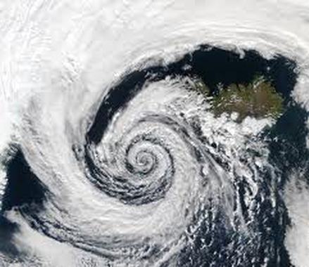
- Low pressure systems can also be call cyclones
- In the northern hemisphere, low pressure systems all have surface winds that rotate counter-clockwise and converge on the center of low pressure
- This is true for storms ranging from light rains to hurricanes
Hurricanes
|
|
|

